
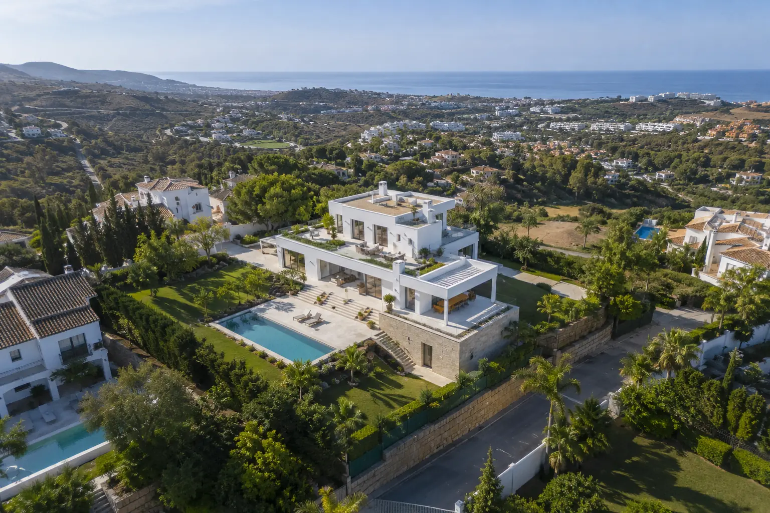
Drone photography can attract attention, but its real value is not simply showing a property from a greater height. It works best when it explains something that ground-level images cannot communicate clearly: the size of the plot, the relationship between outdoor spaces, the views or the location.
Drone photography should add information, not just spectacle
An effective aerial image helps people understand a property within seconds. It can show how the house, pool, garden and terraces connect, or place a villa in relation to the sea, a golf course or the wider Costa del Sol landscape.
When that context is part of the property’s appeal, drone photography becomes a commercial tool rather than a decorative extra.
Properties that usually benefit most from aerial photography
Detached villas, country homes, properties with generous plots and new developments often benefit particularly well from an aerial perspective. It can also be useful for residential communities with strong shared facilities or homes whose location is difficult to explain through interior photographs alone.
The purpose is not to make a property appear larger. It is to present its true proportions and the features that genuinely belong to it.
Location can become part of the story
Across Málaga, Marbella, Mijas, Fuengirola and Benalmádena, many homes are marketed as much for their surroundings as for the building itself. Proximity to the sea, open views, a peaceful residential setting or a relationship with a golf course may influence the decision.
A carefully selected aerial view places the home in context without replacing accurate listing information. It should orient the client rather than create a misleading impression of distance or ownership.
Not every property needs drone images
For an apartment whose strongest selling points are inside, a complete ground-level shoot may be enough. There is also little value in adding numerous similar aerial images simply to increase the size of the gallery.
Before including drone coverage, it is worth identifying exactly what the aerial view will explain. If there is no clear answer, the time may be better spent on the interiors, terrace or a short property video.
Aerial photography works best within a complete shoot
Drone content does not replace professional photography from the ground. Interior images communicate light, materials and layout; exterior photographs present the architecture and usable areas; aerial views add context.
When all three perspectives share a consistent visual style, the listing provides a more complete and professional understanding of the home. You can see this approach in the HannusFoto real estate photography portfolio.
A practical advantage for real estate agencies
For an agency, a strong aerial view can also be reused across its website, social media and property presentations. One image that explains the architecture, plot and surroundings makes the home’s principal selling point easier to communicate while maintaining a consistent visual standard across different marketing channels.
Planning, safety and suitable conditions
Every location needs to be assessed before a flight. Available space, weather, privacy, safety and applicable restrictions may determine whether aerial photography is possible. Drone coverage should therefore be planned as part of the shoot rather than improvised at the last moment.
The time of day also matters. The light needs to support both the property and its surroundings. An aerial photograph that is technically possible is not automatically the most useful image for marketing.
Should your next property include drone photography?
The answer depends on what the listing needs to communicate. If the plot, views, outdoor areas or location are important selling points, a concise selection of aerial images can make a clear difference.
HannusFoto provides real estate photography, video and drone content for agencies, homeowners and holiday rentals across Málaga, Marbella, Mijas, Fuengirola, Benalmádena and the Costa del Sol. Send me the property location and I will recommend the content that can add the most value.